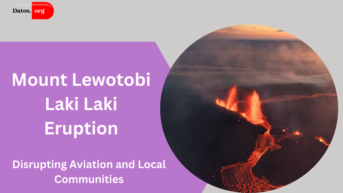
Mount Lewotobi Laki-Laki, located on Indonesia’s Flores Island, awakened from nearly two decades of dormancy in late 2023.
By November 2024, the volcano escalated its activity to explosive eruptions, creating towering ash clouds that disrupted both local communities and international air travel.
These volcanic events sent ash high into the atmosphere, forcing the cancellation of flights and prompting urgent safety measures in the region.

- Satellite Monitoring of Eruption Patterns
- Aviation Threats and Safety Protocols
- Major Flight Disruptions
- Regional Impact and Risk to Aviation
- NASA’s Role in Mitigating Volcanic Hazards
- Conclusion
- People May Ask
- What triggered the eruptions of Mount Lewotobi Laki-Laki?
- Why are volcanic ash clouds dangerous to aviation?
- How did the eruptions impact air travel in Indonesia?
- How does NASA track volcanic ash?
- Why are Indonesia’s airports at high risk for volcanic disruptions?
Satellite Monitoring of Eruption Patterns
On November 13, 2024, NASA’s Landsat 9 satellite captured images of the volcanic plume drifting west from Lewotobi Laki-Laki, reaching 1,200 meters in height.
The eruption’s magnitude earlier in the month, on November 7 and November 9, sent ash plumes to altitudes of 17,000 meters and 15,000 meters respectively. These ash clouds were not only a local threat but also posed a serious risk to air travel across Southeast Asia.
Aviation Threats and Safety Protocols
Ash clouds from volcanic eruptions are hazardous to aviation, especially since they can damage aircraft engines, windshields, and airframes. Commercial airliners flying above 10,000 meters are at particular risk when plumes exceed this altitude.
MUST READ:Kīlauea Volcano: Groundbreaking 120-Year Study Uncovers Crucial Seismic Patterns
NASA’s MODIS sensor aboard the Aqua satellite tracked the movement of these ash clouds, revealing widespread ash dispersion, particularly over Flores Island. As a result, the aviation community closely monitored the plumes to avoid potential collisions with dangerous ash.
Major Flight Disruptions
In response to the volcanic activity, Indonesia raised the aviation alert to red, signaling the highest danger level. On November 13, over 90 flights were canceled, with additional cancellations affecting both domestic and international routes.
Airports across Indonesia, including those in Bali, were temporarily closed, severely affecting travel plans. While some airports reopened by November 14, strict air traffic control measures were implemented to ensure safety.
Regional Impact and Risk to Aviation
Indonesia’s airports face one of the highest risks globally from volcanic activity. Due to the number of active volcanoes and their proximity to major air travel hubs, the region ranks third in the world for the number of airports vulnerable to volcanic hazards.
Volcanic ash poses a significant risk to airliners, and ongoing research is critical to minimizing the impact on global aviation networks.
NASA’s Role in Mitigating Volcanic Hazards
NASA collaborates with global volcanic ash advisory centers to enhance flight safety. By using satellite data to track volcanic ash plumes, the agency helps guide flight paths and avoid hazardous zones.
Their collaboration is vital in improving the response to volcanic activity, ensuring that air traffic can safely navigate through or around these dangerous plumes.
Conclusion
The eruptions of Mount Lewotobi Laki-Laki have had far-reaching consequences, affecting air travel, local communities, and global aviation safety.
By leveraging satellite technology and enhancing international cooperation, steps are being taken to mitigate the risks posed by volcanic ash.
As research continues, authorities are better equipped to manage future volcanic events, minimizing disruptions and ensuring the safety of air travel.
People May Ask
What triggered the eruptions of Mount Lewotobi Laki-Laki?
After nearly two decades of inactivity, the volcano erupted in December 2023, with activity intensifying in November 2024. The eruptions produced massive ash plumes that disrupted air travel and posed risks to the surrounding area.
Why are volcanic ash clouds dangerous to aviation?
Volcanic ash can damage aircraft engines, wings, and windshields, potentially leading to engine failure. Ash clouds at altitudes higher than 10,000 meters are particularly dangerous for commercial flights, which often cruise at those elevations.
How did the eruptions impact air travel in Indonesia?
The eruptions caused over 90 flight cancellations on November 13, 2024, including both domestic and international flights. Airports, especially in Bali, were temporarily closed, causing significant travel disruptions.
How does NASA track volcanic ash?
NASA uses satellites like Landsat 9 and MODIS on Aqua to capture images and monitor volcanic ash plumes. This data helps aviation authorities avoid ash-affected regions, reducing the risks to air traffic.
Why are Indonesia’s airports at high risk for volcanic disruptions?
Indonesia is located along the Pacific “Ring of Fire” and is home to many active volcanoes. This makes its airports highly vulnerable to volcanic eruptions, which can severely disrupt aviation operations.
Click here to learn more.